Nanaimo to Campbell River
Nanaimo to Campbell River (or Refuge Cove)
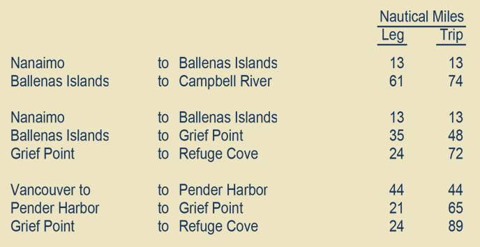
From Nanaimo to Campbell River is 74 miles, an 8- to 9-hour run right up the exposed west side of the Strait of Georgia. The Desolation Sound route, up the much more protected east side of the Strait of Georgia and through the exquisite Desolation Sound area is the alternative. It is 72 miles from Nanaimo to Refuge Cove, just inside Desolation Sound, From Vancouver to Refuge Cove, via Pender Harbor, is 89 miles.
The Desolation Sound route is about ten miles longer to the Broken Islands than the Campbell River Route. At the Broken Islands in Johnstone Strait is the next route decision point.
Apart from the spectacular beauty of the Desolation Sound area, the Desolation Sound route runs through Cordero, Chancellor and Sunderland Channels, thus minimizing travel in Johnstone Strait. It is more scenic than the Campbell River route, has more wildlife and better fishing, but you miss Campbell River.
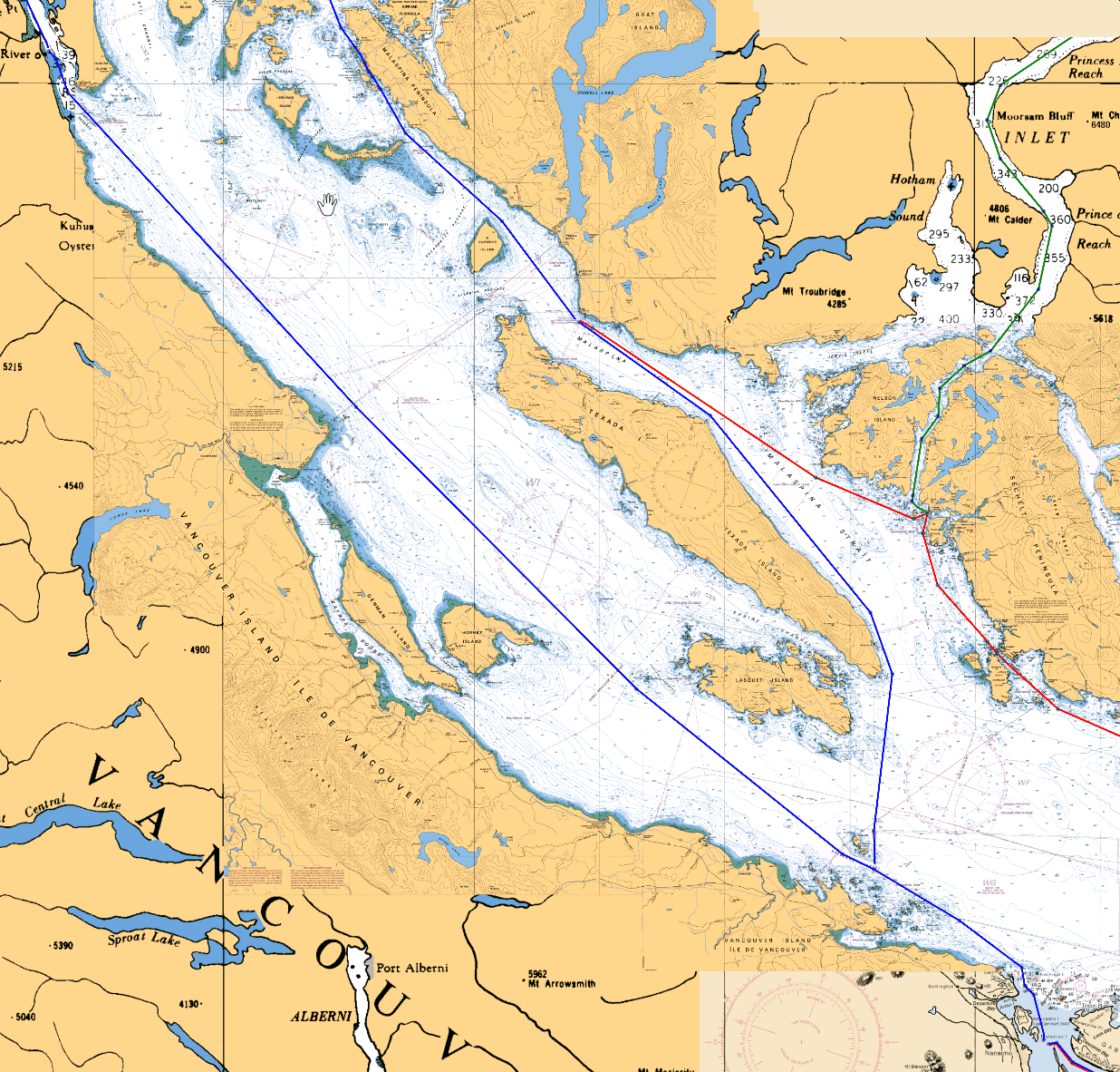
Area Overview
On the chart below, the blue course line running up the west side of the Strait of Georgia is the direct route from Nanaimo to Campbell River, a robust little city of 31,000.
The blue course line running north out of Nanaimo and then northwest on the east side of Texada Island and up the mainland coast to the top of the chart is the route into Desolation Sound.
At the top of the chart, Sarah Point on the tip of the Malaspina Peninsula extends just beyond the edge of the chart. 3 1/2 miles beyond Sara Point is Refuge Cove, one of the few outposts of civilization in the broad expanse of Desolation Sound area.
The red course line coming in from the right side of the chart is coming from Vancouver. It passes through Pender Harbor, a delightful community on the Sechelt Peninsula. From Pender, it continues on and joins the blue course line into Desolation Sound.
Comparatively speaking, there is not much of spell-binding interest on any of the delineated routes on this chart. The one exception is the green course line which runs 44 miles up Jervis Inlet to Princess Louisa and Chatterbox Falls. That's a long way to go to see a waterfall given all that lies ahead.
Unless one is on a fast delivery run to Ketchikan, or needs to avail himself or herself of the wide variety of retail outlets or the marine services available in Campbell River, the preferred course is almost always the Desolation Sound route.